The Black Hills
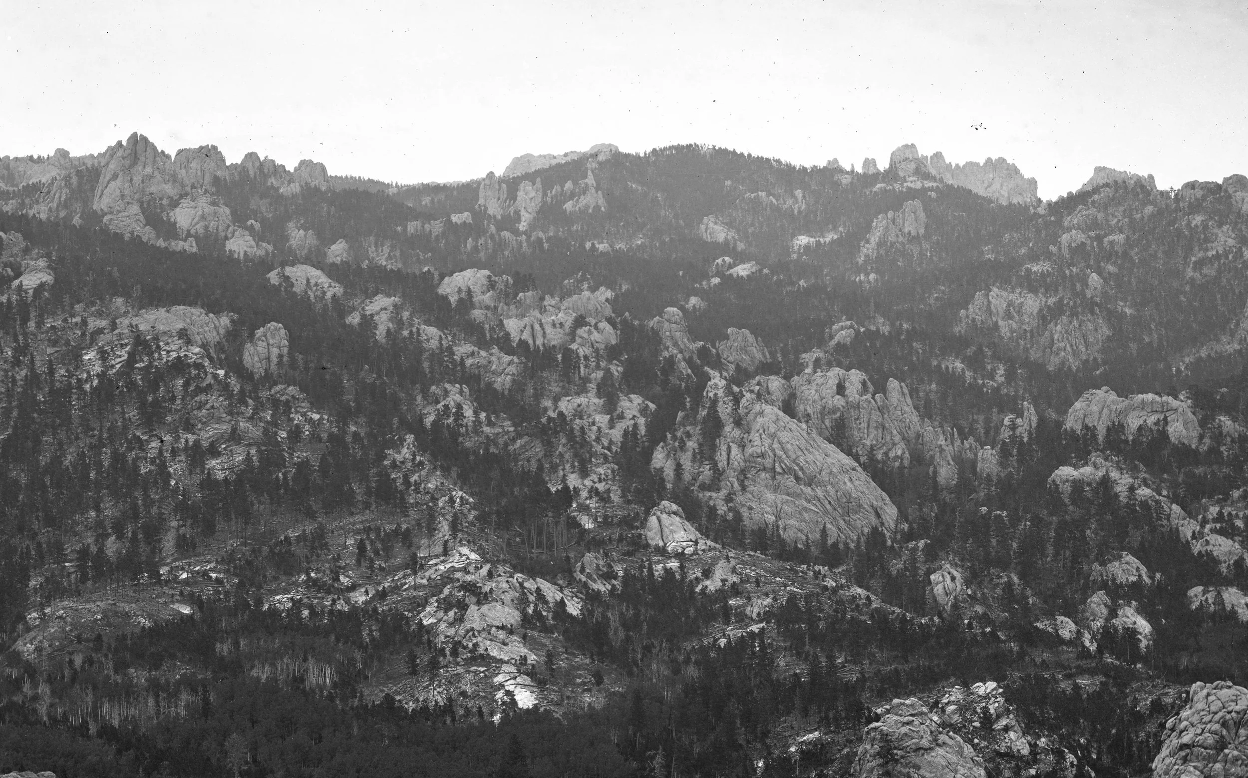
A vista of the Black Hills in 1874
Hennepin County Library via Wikimedia - Public Domain
Located along the western edge of South Dakota, and spilling over into neighboring Wyoming, the Black Hills are today probably most famous for the monumental faces carved onto Mount Rushmore. This iconic American landmark, drawing millions of tourists each year, was conceived in the aftermath of the First World War in the 1920s, and was (controversially) sited on the location known to the local Lakota tribes as Tȟuŋkášila Šákpe, or The Six Grandfathers. Named for the six cardinal directions in Lakota tradition (North, South, East, West, Sky and Earth), this was a sacred site used for hunting and religious purposes since they had conquered the region from the Kiowa¹ in the late 18th century, as it had for tribes before them.
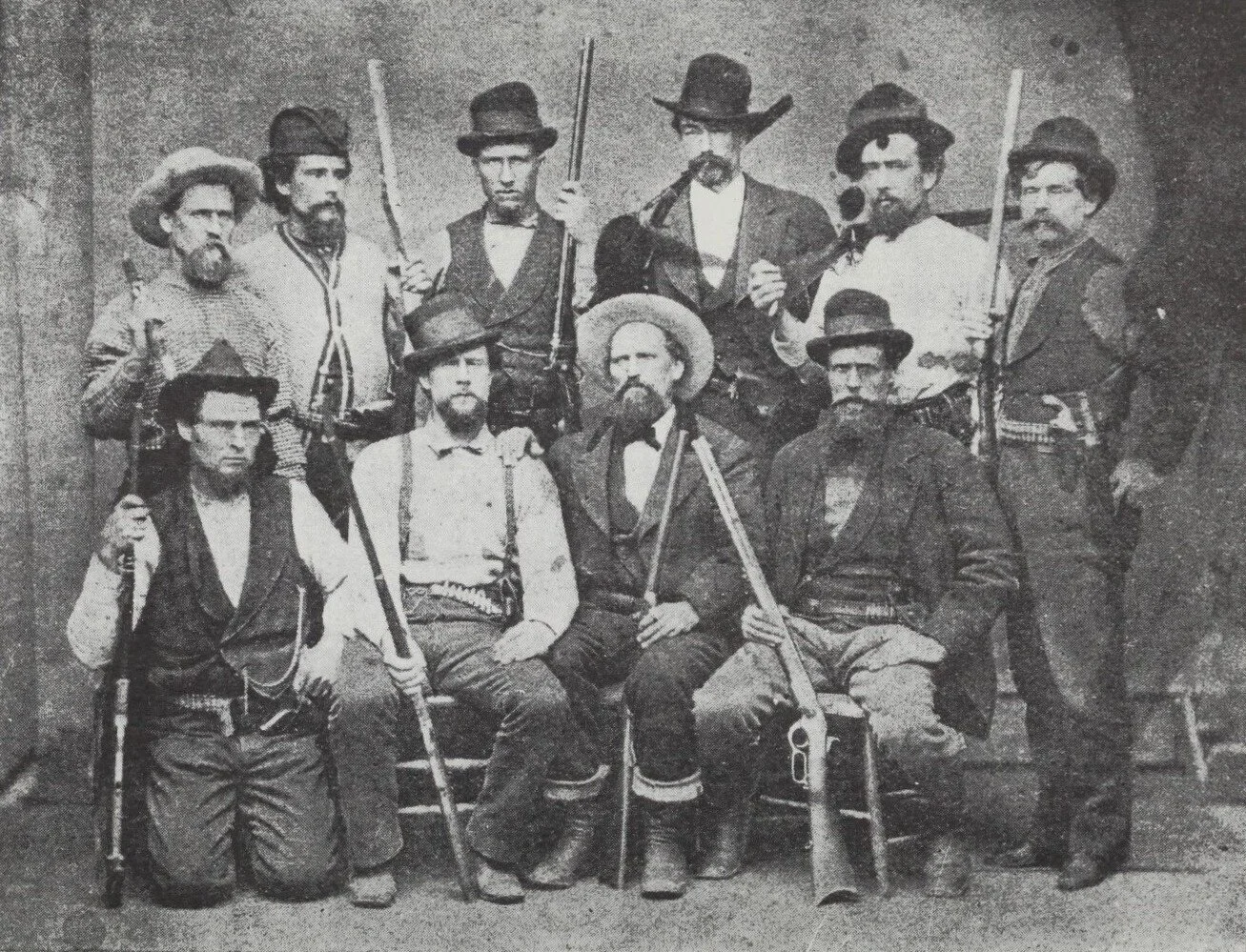
A group of prospectors removed by the US Army from the Black Hills in 1875
Public Domain
The Black Hills themselves were named by the natives (Paha Sapa) for the dark color that the peaks take on when viewed from a distance², and they had been ceded to the Sioux with the Fort Laramie Treaty of 1868, creating the Great Sioux Reservation following the end of war with the Sioux led by Ogala Chief Red Cloud. Despite this, the westward expansion of the United States in the aftermath of the Civil War began almost immediately to encroach on the new reservation, with the expansion of the wagon trails and railroads to the west running directly through the supposedly ceded territory with little regard for the inhabitants.

7th Cavalry officers during the 1874 expedition. Among these men is Colonel Fred Grant, son of the President
Hennepin County Library via Wikimedia - Public Domain
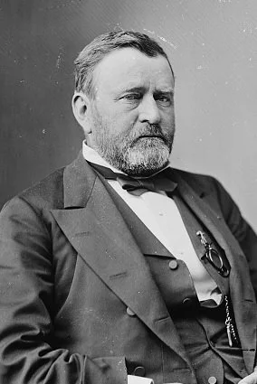
President Grant
Library of Congress - Public Domain
Meanwhile, economic strife gripped that nation in 1873 as a component of a global financial crisis that became known as the Panic of 1873, resulting in great numbers of unemployed men seeking their fortunes in the west³. The Black Hills had long been rumored to contain large deposits of gold, and in 1857 an Army survey party had confirmed its location. Fueled by hopes of striking rich, a large influx of illegal prospectors began to stream into the region, and in 1874 the administration of President Ulysses S. Grant ordered another Army expedition into the region.
The US 7th Cavalry Regiment was detailed for the expedition, departing for the Black Hills from Fort Abraham Lincoln in North Dakota with a strong force in July of 1874, confirming that substantial quantities were present. The expedition’s commanding officer, one George Custer, even going so far as declaring upon his return to Fort Lincoln that the area was not only rich in the precious metal but also that it was easily accessible even to novices. Reports such as these quickly found their way to the press, and over the next two years the small collection of prospectors in the Black Hills ballooned to over 10,000⁴.

General Custer (center) with Arikara scout Bloody Knife and men of the 7th Cavalry with a recently killed grizzly bear during the 1874 Black Hills Expedition
Library of Congress - Public Domain
Attempts were made to purchase the Black Hills from the Sioux, but these caused division between peaceful and more militant tribal leaders, and in the end the Federal Government was unwilling to meet the seventy million dollar price put forward by the peace faction. Red Cloud travelled to Washington with Sichangu Chief Spotted Tail to convey this offer to the government, while the more hostile Ogala Crazy Horse and Hunkpapa Sitting Bull refused to entertain even such a meeting, but sending word that if need be they and their tribesmen would defend the Paha Sapa to the death⁵. A government commission was dispatched to the Great Sioux Reservation later in the year, with the same results.

The Sioux delegation to Washington in 1874. Back row, left to right: Julius Meyer (interpreter), Red Cloud (Oglala). Front row, left to right: Sitting Bull (Oglala, not to be confused with the more famous Hunkpapa Chief), Swift Bear (Arapaho), Spotted Tail (Broule)
Public Domain - Wikimedia
The subsequent change of the Grant Administration’s Indian Policy amounted to the Army ceasing any attempts to block the influx of prospectors into the Black Hills, and in turn they would begin operations in the new year against any natives found outside of the reservation’s boundaries. The plan put forward at the highest levels called for a campaign over winter, targeting the tribes in their winter camps when they lacked the freedom of movement that had historically been one of their major advantages. Declaring all natives not on the reservations as “hostile” on 1 January, planners knew full well that most would be unable to do so in the dead of winter, and indeed most would not even be able to receive word of the order before the spring thaw.
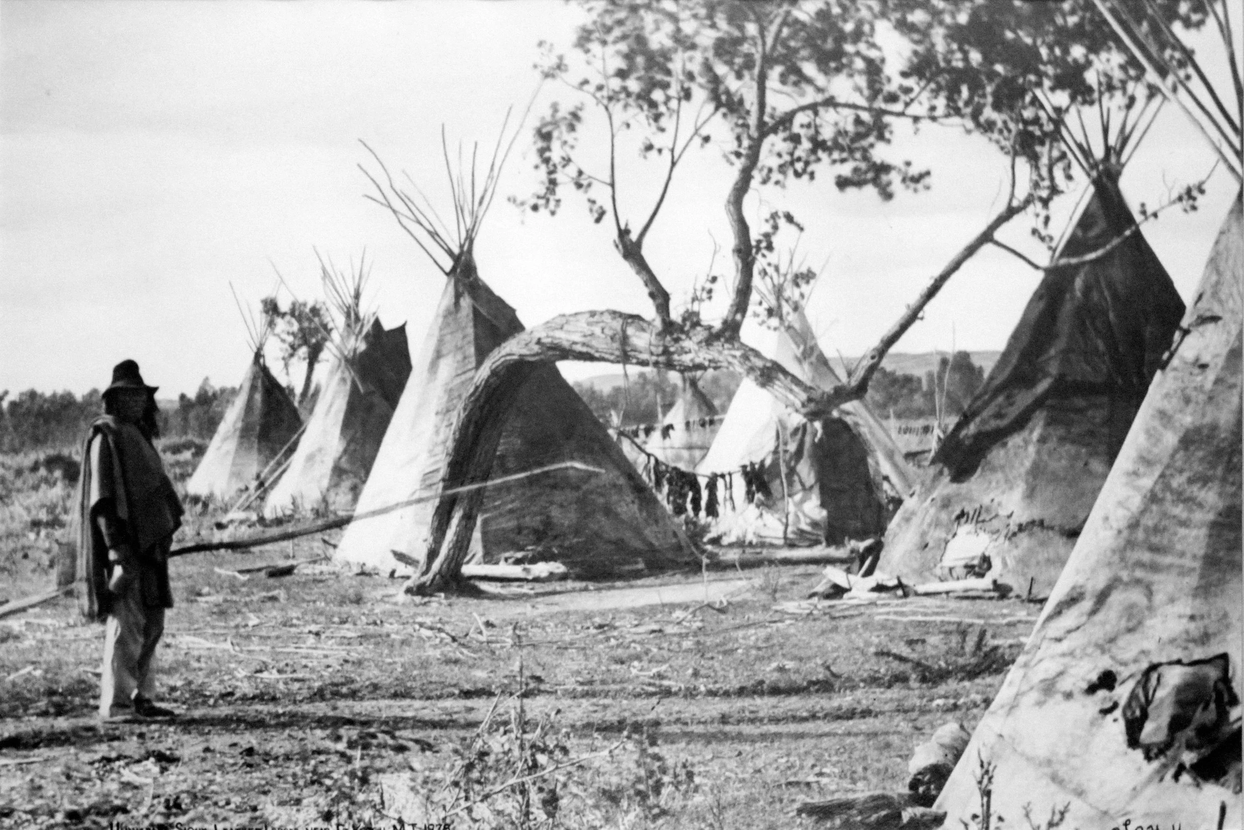
A Hunkpapa Lakota village in the 1870s
Public Domain
Delays would occur, however, in the Army’s timetable, due to political issues in Washington and difficulty in getting supplies and troops to their intended start points. The plan called for three detachments to march into Sioux territory; one each from Fort Abraham Lincoln in North Dakota (the 7th Cavalry), Fort Ellis in Montana (2nd Cavalry) and Fort Fetterman in Wyoming (3rd Cavalry). Additional infantry and support units would also accompany the cavalry, along with scouts from friendly tribes, withe force advancing northwards under Brigadier General George Crook being the largest. While intending to set out in late March or early April, it was not until mid May that the expedition would finally begin, by this time the plan for a winter strike having died as the Sioux moved out of their winter camps.
-
Robinson, p.6
Donovan, p.31
Donovan, p.33
Donovan, p.32
Donovan, p.33